
Cuantificación de la deforestación en el occidente de Honduras


CUANTIFICACIÓN DE LA DEFORESTACIÓN EN LAS ÁREAS DE INTERVENCIÓN DE LA ACTIVIDAD GOBERNANZA EN ECOSISTEMAS, MEDIOS DE VIDA Y AGUA (USAID/GEMA) EN EL OCCIDENTE DE HONDURAS
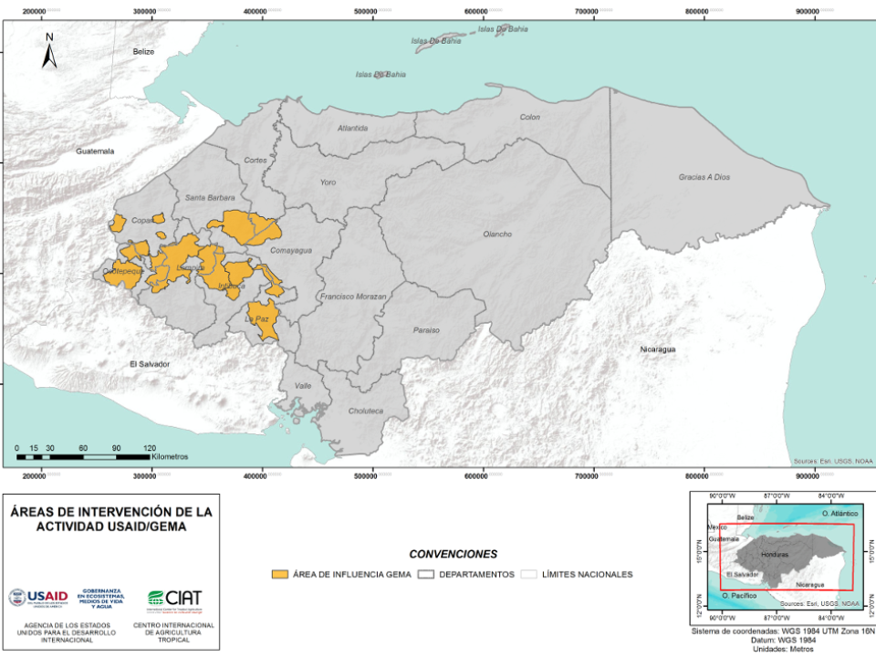
ZONA PILOTO: SANTA ROSA DE COPÁN, MONTAÑA VERDE -OPALACA, MONTECILLOS, MIXCURE, LAGO DE YOJOA, GÜISAYOTE, ERAPUCA, EL JILGUERO, COCOYAGUA, CELAQUE-PUCA, ANILLO VERDE Y COPÁN RUINAS.
Resumen
En el occidente hondureño, se desarrolló como parte del segundo nivel de la metodología Terra-i, la cuantificación de la deforestación para los años 2017 y 2018 en zonas piloto establecidas dentro de la actividad de USAID en las áreas GEMA, utilizando un método capaz de detectar alteraciones en el comportamiento de la vegetación a través del análisis de series temporales, conocido como LandTrendr, mediante la robusta y novedosa plataforma de procesamiento Google Earth Engine.
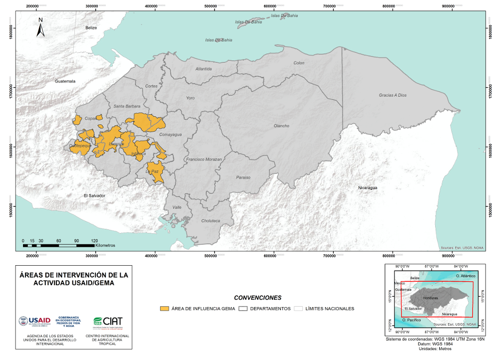
Figura 1. Ubicación de las áreas de intervención de la actividad USAID/GEMA
Contexto
Durante el 2018, USAID-Honduras se encuentra desarrollando un proyecto con el que pretende reforzar las exitosas políticas ambientales que fueron implementadas en el proyecto ProParque en 2011-2016 (carhon, 2017), estableciendo métodos ambientalmente sostenibles, incluyendo el termino de sostenibilidad en la economía, e informando a las comunidades sobre el cuidado de su entorno y la resiliencia a los cambios del clima para evitar desastres naturales.
En consecuencia, se ha desarrollado una labor en el occidente de Honduras dentro del marco de la actividad de USAID en las áreas de GEMA, con la intención de analizar los cambios biofísicos que se han presentado sobre los bosques a través de los niveles manejados por Terra-i Honduras, en donde el primer nivel consiste en generar alertas tempranas de deforestación en tiempo casi real (cada 16 días) con imágenes de resolución espacial moderada, el segundo nivel es la cuantificación de la deforestación con imágenes con resolución detallada, y por último, la validación de la información de los primeros dos niveles que es detallada en un blog de terra-i titulado “Identificación de causas de pérdida de cobertura vegetal en el occidente hondureño”.
Las pérdidas de bosque o deforestación, ha sido fuertemente estudiada desde las ultimas 2 décadas para poder entender la transformación que sufre la cobertura forestal. Estas investigaciones se han realizado a través de métodos basados en percepción remota a diferentes escalas, utilizando diversas imágenes de satélite de acuerdo a la disponibilidad, la resolución espacial y la resolución temporal (Redo, Bass, & Millington, 2009).
Además, integrando la percepción remota con herramientas como los Sistemas de Información Geográfica (SIG), imágenes de alta resolución como las disponibles en Google Earth Pro (GE-PRO), y plataformas de procesamiento como Google Earth Engine (GEE), ha permitido implementar un método para detectar las perturbaciones o cambios en los bosques dentro de las áreas piloto de la actividad.
Método
La cuantificación de la deforestación sobre las áreas piloto, se ha desarrollado a través de la plataforma GEE haciendo uso de a.) algoritmos semi-automatizados, b.) metodologías para detectar deforestación como el método LandTrendr, el cual consiste en la detección de alteraciones en el comportamiento de la vegetación en el tiempo, c.) y altos volúmenes de datos espaciales disponibles desde 1985 hasta el 2018, con el fin de determinar las perturbaciones en la cobertura forestal para los años 2017 y 2018 , haciendo uso de diferentes imágenes satelitales como, Sentinel-2 (S-2), Landsat 5 (L5), Landsat 7 (L7) y Landsat 8 (L8). A continuación, se presenta un ejemplo del comportamiento del verdor la vegetación sobre una región deforestada:
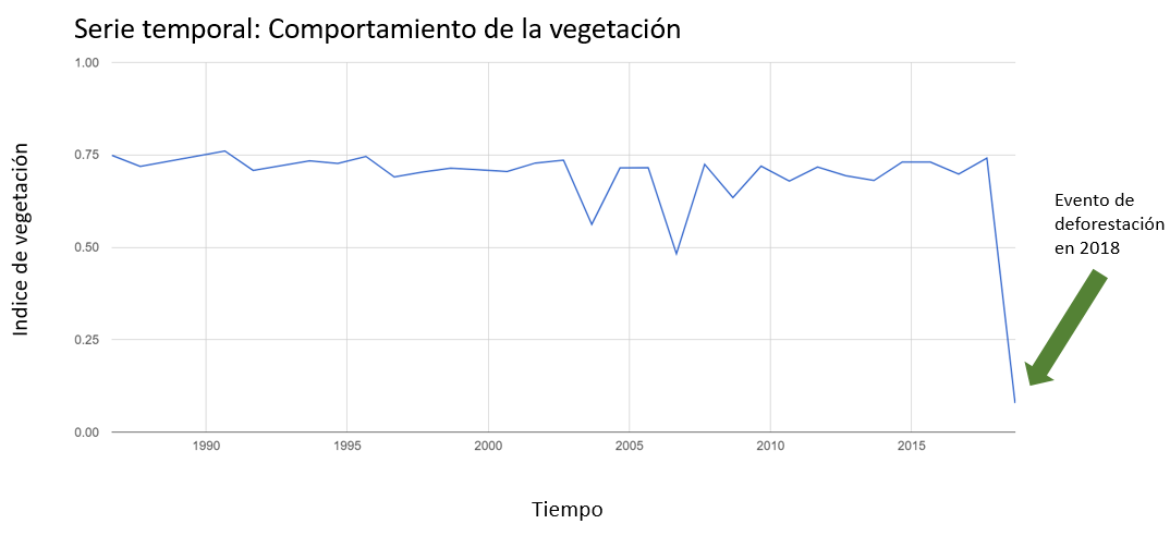
Figura 2. Comportamiento de la vegetación. Evidencia de cambio de cobertura para el año 2018
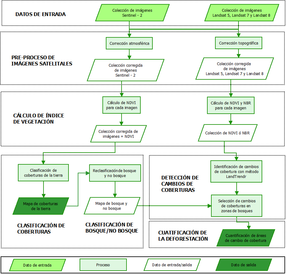
Figura 3. Metodología para cuantificación de deforestación
Mediante un mapa de coberturas de la tierra para el año 2017 elaborado con imágenes Sentinel-2, con especificaciones detalladas en el blog “Mapeo de coberturas de la tierra para el 2017, en el occidente hondureño sobre áreas de intervención de la actividad Gobernanza en Ecosistemas, Medios de Vida y Agua (USAID/GEMA)” que se encuentra en la página de Terra-i, se realiza un mapa de bosque/no bosque, que sirve como máscara para seleccionar únicamente los cambios de coberturas ubicados en la cubierta forestal.
En cuanto a las imágenes L5, L7 y L8, se utilizaron para realizar la cuantificación de la deforestación, puesto que cumplen con una de las condiciones que requiere el método LandTrendr, y es la alta disponibilidad de información, debido a que se encuentran datos disponibles desde 1985 hasta la actualidad.
Finalmente, teniendo como resultados el mapa de bosque/no bosque y las detecciones de deforestación, se seleccionan los cambios que se encuentran en zonas boscosas para excluir las alteraciones que ocurren en otro tipo de coberturas. Debido a que el método también detecta perturbaciones en áreas de cultivos y en otros tipos de vegetación.
Resultado
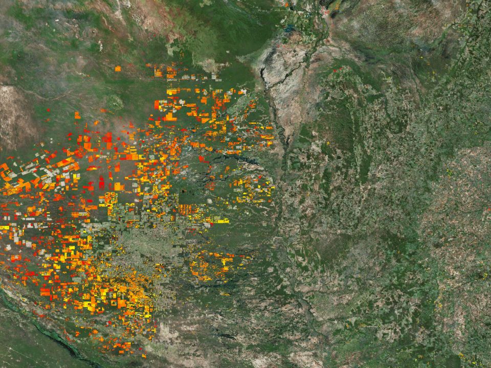
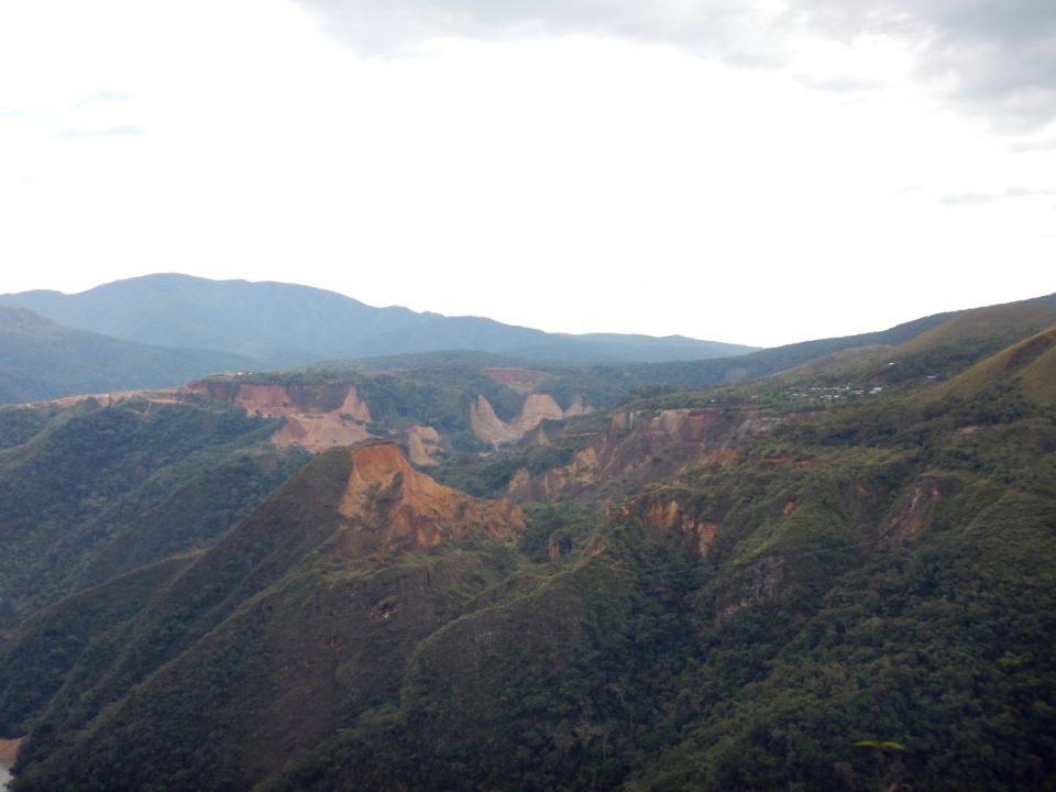
La deforestación en las áreas piloto de la actividad de USAID en las áreas GEMA, presenta cinco puntos calientes de deforestación en zonas como El Jilguero o también conocido como La Paz, Montecillos, Mixcure y Anillo Verde, así como se muestra en la Figura 4.
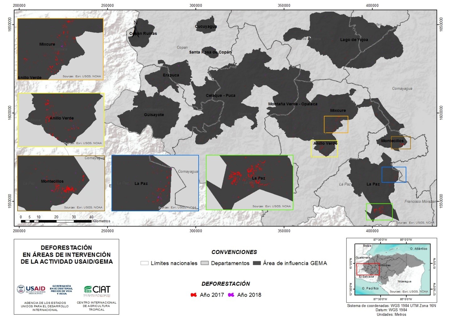
Figura 4. Deforestación en áreas de intervención de la actividad de USAID en las áreas GEMA
Si se discrimina esta información por años, en el 2017 se presenta la mayor cantidad de pérdida de bosque dentro de las áreas piloto analizadas, alcanzando un 0.20% de deforestación, mientras que en el 2018 presentan 0.10% en cambio de cobertura forestal.
Al igual que las alertas detectadas por la Terra-i en el nivel 1, El Jilguero está entre las zonas más afectadas por la deforestación, así como se evidencia en las Figuras 4 y 5, mientras que otras áreas presentan leves variaciones entre los dos métodos debido a que las alertas son sensibles a cambios en diferentes tipos de cobertura vegetal y las detecciones con el método LandTrendr fueron filtradas solamente en áreas de bosque.
La siguiente figura muestra un resumen de la cantidad de área deforestada por año en las zonas piloto:
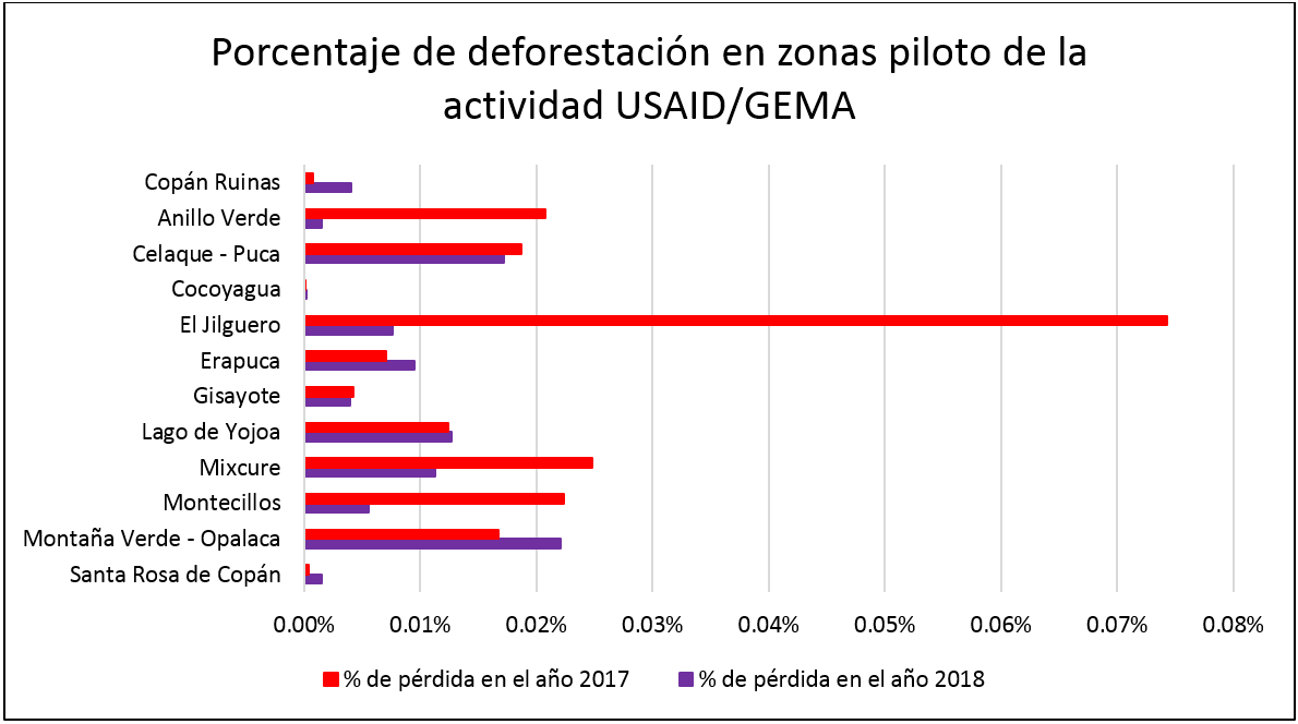
Figura 5. Área de deforestación sobre las áreas pilotos de la actividad de USAID en las áreas de GEMA, discriminada por año.
Conclusión
Para la detección de cambios de cobertura a escalas pequeñas, principalmente en actividades como el monitoreo de subcuencas hidrográficas, es necesario complementar las detecciones que realiza Terra-i con metodologías como LandTrendr, ya que esta última permite obtener cifras detalladas de las áreas de perdida de cobertura vegetal. Además, si se comparan estos dos métodos, cada uno presenta diferentes ventajas en cuanto a la resolución espacial y temporal.
Terra-i es una herramienta que tiene como ventaja la periodicidad de la información, debido a que los datos de alertas tempranas se generan en tiempo casi real (cada 16 días), mientras que LandTrendr necesita reducir los datos a una cifra por año. Por otro lado, LandTrendr lleva la ventaja en el momento de detectar áreas muy pequeñas de deforestación, gracias a la resolución espacial de las imágenes Landsat que utiliza, puesto que el tamaño de su pixel abarca 0.09 hectáreas, mientras que los datos MODIS de Terra-i tienen una dimensión de 6.25 hectáreas.
Por estas razones, Terra-i y LandTrendr son un conjunto de herramientas que se complementan entre sí para monitorear la deforestación, puesto que la primera genera alertas tempranas que permiten tomar medidas preventivas, mientras que la segunda proporciona datos para evaluar la magnitud del daño generado en los bosques.
Agradecimientos
La cuantificación de la deforestación fue realizada por el Centro Internacional de Agricultura Tropical (CIAT) en colaboración con la actividad de Gobernanza en Ecosistemas Medios de Vida y Agua de la Agencia de los Estados Unidos para el Desarrollo Internacional, Honduras (USAID-Honduras por sus siglas en inglés) y los Especialistas en Monitoreo Forestal (UMF), Instituto Nacional de Conservación y Desarrollo Forestal, Áreas Protegidas y Vida Silvestre (ICF).
Bibliografia
carhon. (19 de Julio de 2017). USAID ProParque. Obtenido de http://care.org.hn/usaid-proparque/
Redo, D., Bass, J. O., & Millington, A. C. (2009). Forest dynamics and the importance of place in western Honduras. Applied Geography, 29(1), 91-110. doi:http://dx.doi.org/10.1016/j.apgeog.2008.07.007
Escrito por: Jorge Andrés Perez Escobar


The Terra-i team together with CRS El Salvador under the Raices project carried out a virtual workshop through the teams platform to technicians from the Ministry of Environment and Natural Resources, CARITAS, Universidad El Salvador, CENTA, about the Mapping of land cover using remote sensors and open source tools such as GEE, SEPAL and QGIS- Plugin Semi Automatic Classification.


Near real-time vegetation loss detection in Southwestern Ethiopia: calibration, validation, and implementation of the Terra-i system


The Alliance of Bioversity International and the International Center for Tropical Agriculture (CIAT) (the Alliance) conducted a training for local stakeholders on the use of Terra-i as part of the collaboration with the Netherlands Development Organisation – SNV in the Coffee Agroforestry and Forest Enhancement for REDD+ (CAFÉ-REDD) Project.


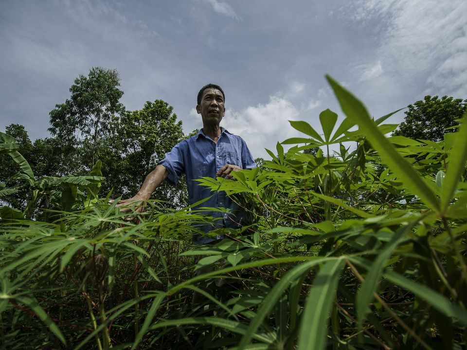
IDENTIFICACIÓN DE CAUSAS DE PÉRDIDA DE COBERTURA VEGETAL EN LAS ÁREAS DE INTERVENCIÓN DE LA ACTIVIDAD GOBERNANZA EN ECOSISTEMAS, MEDIOS DE VIDA Y AGUA (USAID/GEMA) EN EL OCCIDENTE DE HONDURAS

MAPEO DE COBERTURAS DE LA TIERRA PARA EL 2017, EN EL OCCIDENTE HONDUREÑO SOBRE ÁREAS DE INTERVENCIÓN DE LA ACTIVIDAD GOBERNANZA EN ECOSISTEMAS, MEDIOS DE VIDA Y AGUA (USAID/GEMA)

An international team of scientists*, involving entomologists, conservation biologists, agro-ecologists and geographers, has just revealed how on-farm insect biological control can slow the pace of tropical deforestation and avert biodiversity loss on a macro-scale. The case study concerns biological control of the invasive mealybug Phenacoccus manihoti with the introduced host-specific parasitic wasp Anagyrus lopezi in Southeast Asia. The results of this study have just been published in Communications Biology – Nature.


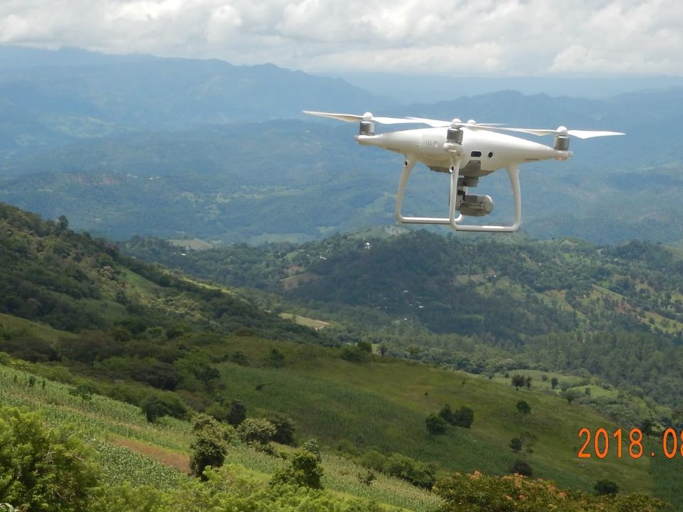
From May 8-12, 2017, the Terra-i team, together with staff from the DGOTA of Peru's Ministry of Environment, carried out the first field validation of vegetative land cover changes detected during Terra-i monitoring for 2016 and 2017, using the technology UAV. This work was carried out under the framework of the project “Sustainable Amazonian Landscapes”. The team carried out over-flights with a Phantom 3 advanced rotor drone and a fixed-wing Ebee drone in seven townships of Yurimaguas. The objective of this work was to recognize the dynamics of land cover and land use changes in the region while at the same time to validate the accuracy of the detections of forest loss being monitored by Terra-i in Yurimaguas.

CIAT and the Terra-i team are pleased to announce the publication of a new study in Paraquaria Natural, the most prestigious journal in Paraguay dedicated to biodiversity and the conservation of nature.


The Terra-i team has worked hard on renovating Terra-i’s website since early this year. A set of new features on the website provides interactive contents and facilitates adaptation to the mobile devices of our users. The fresh website was developed using the latest update of an open-source, Java-based web system, Magnolia CMS 5.4.4. This update was customized to add different categories of interaction such as news, vegetation cover changes, and information, among others.


Globally more than 1 billion people depend on forests for their livelihoods. Forests play a crucial role in climate regulation, ecosystem services provision and regulation, water supply, carbon storage and many other functions that support biodiversity. Currently the global rate of deforestation is substantial, and there is a growing need for timely, spatially explicit data that flag natural vegetation changes due to human activities.
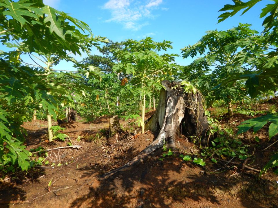

New deforestation hotspots point the finger at my favourite fruit I love Terra-i, but today I hate it. A lot. The system uses satellite images to track deforestation in the Amazon in near-realtime. It’s extremely accurate: if a bunch of trees come down somewhere – no matter how remote – Terra-i picks it up. Cool, right? Not today. CIAT’s Louis Reymondin, the system’s chief architect, dropped the bombshell over coffee: it looks as though hundreds of hectares of rainforest in Peru are being trashed by… papaya.


The latest update of Terra-i has been used with the Co$ting Nature ecosystem services assessment tool to understand the impacts of recent forest loss in Colombia on biodiversity and ecosystem services.

The production of geospatial data related to land-use and land cover changes by governments and civil society organizations has vastly increased during the last decade. Going beyond the valuable information (location, rates and absolute values of changes) provided by these datasets, it is important to have a better understanding of the spatial configurations and composition of the detected change areas at multiple spatial resolutions and time periods. Alejandro Coca-Castro’s research is aiming to map types of spatial deforestation patterns in the Amazon rainforest through the integration of landscape fragmentation metrics and data mining techniques. The research will contribute to the understanding of two deforestation datasets (Terra-i and GFC) and is part of his master dissertation at King’s College London. This blog post highlights Alejandro’s research methodology, preliminary findings and challenges.

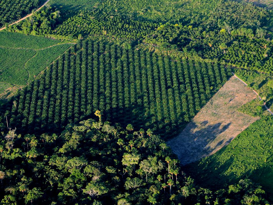
Ecuador is recognized as one of the biodiverse hotspots on earth, underneath the Amazon rainforest lies the country’s oil reservoir. With the oil companies and cleared routes come settlers, therefore more and more of this diverse rainforest is being cut down. Since the oil concerns entered the Ecuadorian Amazon 45 years ago, they keep exploring and exploiting the area. The Terra-i detections reveal a total habitat loss of 87,525 Ha, 16,943 Ha (19%) is part of protected areas, between January 2004 and February 2015.
IDENTIFICACIÓN DE CAUSAS DE PÉRDIDA DE COBERTURA VEGETAL EN LAS ÁREAS DE INTERVENCIÓN DE LA ACTIVIDAD GOBERNANZA EN ECOSISTEMAS, MEDIOS DE VIDA Y AGUA (USAID/GEMA) EN EL OCCIDENTE DE HONDURAS
MAPEO DE COBERTURAS DE LA TIERRA PARA EL 2017, EN EL OCCIDENTE HONDUREÑO SOBRE ÁREAS DE INTERVENCIÓN DE LA ACTIVIDAD GOBERNANZA EN ECOSISTEMAS, MEDIOS DE VIDA Y AGUA (USAID/GEMA)
An international team of scientists*, involving entomologists, conservation biologists, agro-ecologists and geographers, has just revealed how on-farm insect biological control can slow the pace of tropical deforestation and avert biodiversity loss on a macro-scale. The case study concerns biological control of the invasive mealybug Phenacoccus manihoti with the introduced host-specific parasitic wasp Anagyrus lopezi in Southeast Asia. The results of this study have just been published in Communications Biology – Nature.
CIAT and the Terra-i team are pleased to announce the publication of a new study in Paraquaria Natural, the most prestigious journal in Paraguay dedicated to biodiversity and the conservation of nature.
New deforestation hotspots point the finger at my favourite fruit I love Terra-i, but today I hate it. A lot. The system uses satellite images to track deforestation in the Amazon in near-realtime. It’s extremely accurate: if a bunch of trees come down somewhere – no matter how remote – Terra-i picks it up. Cool, right? Not today. CIAT’s Louis Reymondin, the system’s chief architect, dropped the bombshell over coffee: it looks as though hundreds of hectares of rainforest in Peru are being trashed by… papaya.
The production of geospatial data related to land-use and land cover changes by governments and civil society organizations has vastly increased during the last decade. Going beyond the valuable information (location, rates and absolute values of changes) provided by these datasets, it is important to have a better understanding of the spatial configurations and composition of the detected change areas at multiple spatial resolutions and time periods. Alejandro Coca-Castro’s research is aiming to map types of spatial deforestation patterns in the Amazon rainforest through the integration of landscape fragmentation metrics and data mining techniques. The research will contribute to the understanding of two deforestation datasets (Terra-i and GFC) and is part of his master dissertation at King’s College London. This blog post highlights Alejandro’s research methodology, preliminary findings and challenges.
Ecuador is recognized as one of the biodiverse hotspots on earth, underneath the Amazon rainforest lies the country’s oil reservoir. With the oil companies and cleared routes come settlers, therefore more and more of this diverse rainforest is being cut down. Since the oil concerns entered the Ecuadorian Amazon 45 years ago, they keep exploring and exploiting the area. The Terra-i detections reveal a total habitat loss of 87,525 Ha, 16,943 Ha (19%) is part of protected areas, between January 2004 and February 2015.