

Terra-i user manual for monitoring land-cover changes is now available


Terra-i, a project by CIAT’s Decision and Policy Analysis (DAPA) and Agroecosystems and Sustainable Landscapes (ASL) research areas, presents its “User manual – Near real-time monitoring system for the detection of vegetation loss in the tropics.” The manual is a technical guide that explains step by step the process to use satellite information to issue early warnings on land-cover changes. It is freely available for download, and is targeted to technicians involved in mapping deforestation and land-use changes, interested in the applicability of the resulting data in a range of fields, such as identification of areas of interest for implementing REDD+ projects, capacity strengthening for protected areas management, surveillance of micro watersheds, impact analysis of environmental policies, among other applications. All of this aimed at contributing to forest preservation and management.
The Terra-i tool enables stakeholders to use the data at different levels to take action in natural resource management and create synergies between national and local institutions for protecting and conserving natural resources, as well as enhancing related governance processes, at national and subnational scales.
The manual was prepared within the framework of an inter-institutional cooperation agreement between the Peruvian Ministry of Environment (MINAM) and the International Center for Tropical Agriculture (CIAT), and was used originally in Spanish for a series of training sessions with the aim of implementing an early warning system in Peru. Likewise, the training material has been used to build capacity among technicians in Colombia and Honduras, and other stakeholders interested in forest monitoring.
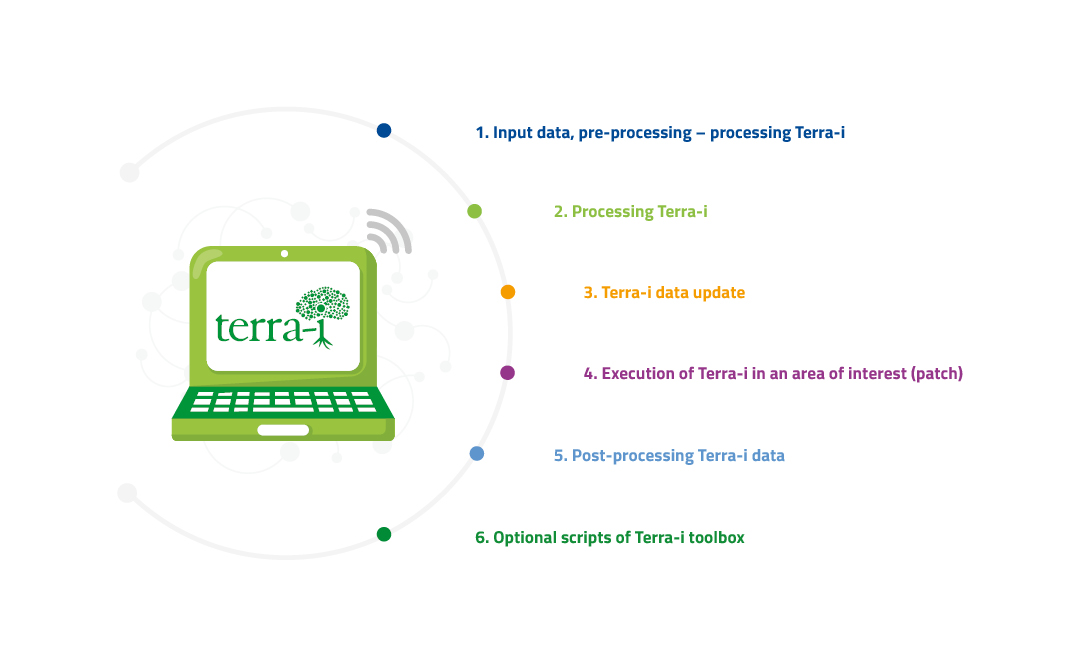
The Terra-i manual provides instructions to use the system from the software installation to the mapping of vegetation loss every 16 days and generation of statistical analysis of the rate of land-cover change. It also includes a detailed methodology and codes used by CIAT researchers for monthly updating the early warnings on land-cover change in the tropics (Latin America, Asia, Africa, and Oceania). The manual comprises the following six chapters:
|
“The Terra-i manual is an important guide to help the users who have shown interest in the system to understand, in an easy, clear manner, how it operates and the processes carried out to issue warnings. Moreover, it is useful to clear up any doubts that may arise when processing information. For our team, it is important as well to have a manual to help us standardize the processes we carry out on a regular basis” Jhon Jairo Tello Dagua Systems analyst, CIAT |
Terra-i is a monitoring system that provides users with analysis of MODIS (NVDI) and TRMM (rainfall) images that forecast changes due to anthropic interventions, in near real time, at a 250 m resolution. It was first developed and rolled out in Latin America in 2012, and then made available to Asia, Africa, and Oceania in 2016. Since June 2012, Terra-i has data freely available for download at www.terra-i.org. Today, a map of vegetation loss is generated every 16 days and kept on record together with data from January 2004 until today, at pan-tropical level.
Terra-i.org is a free web-based tool that facilitates specialized information for sustainably harnessing and conserving natural resources and ecosystems.
As of today, the tool has been adopted and implemented by national and subnational governments in Peru, Colombia (Valle del Cauca department), Honduras, and Vietnam, joining efforts based also on their experience and local knowledge. The Terra-i team continues to develop and apply new machine learning and remote sensing methodologies to achieve higher spatial-temporal resolution. Those methodologies are being incorporated to build a more robust multi-level monitoring system for land-cover and land-use changes with the aim of delivering more accurate information, thus helping strengthen conservation law enforcement and improve transparency in forest monitoring across the tropics.
|
ACKNOWLEDGMENTS Terra-i was developed in 2006 by the International Center for Tropical Agriculture (CIAT), in collaboration with The Nature Conservancy (TNC), the University of Applied Sciences of Western Switzerland (HEIG-VD), and King’s College London (KCL), with financial support from TNC, the CGIAR Research Program on Forests, Trees and Agroforestry (FTA), and Global Forest Watch (GFW). The Terra-i user manual was prepared under the Sustainable Amazonian Landscapes (SAL) project, which is part of the International Climate Initiative (IKI). The German Federal Ministry for the Environment, Nature Conservation and Nuclearsupports this initiative based on a decision adopted by the German Bundestag. |
Originally post on https://blog.ciat.cgiar.org/terra-i-user-manual-for-monitoring-land-cover-changes-is-now-available/


The Terra-i team together with CRS El Salvador under the Raices project carried out a virtual workshop through the teams platform to technicians from the Ministry of Environment and Natural Resources, CARITAS, Universidad El Salvador, CENTA, about the Mapping of land cover using remote sensors and open source tools such as GEE, SEPAL and QGIS- Plugin Semi Automatic Classification.


Near real-time vegetation loss detection in Southwestern Ethiopia: calibration, validation, and implementation of the Terra-i system


The Alliance of Bioversity International and the International Center for Tropical Agriculture (CIAT) (the Alliance) conducted a training for local stakeholders on the use of Terra-i as part of the collaboration with the Netherlands Development Organisation – SNV in the Coffee Agroforestry and Forest Enhancement for REDD+ (CAFÉ-REDD) Project.


IDENTIFICACIÓN DE CAUSAS DE PÉRDIDA DE COBERTURA VEGETAL EN LAS ÁREAS DE INTERVENCIÓN DE LA ACTIVIDAD GOBERNANZA EN ECOSISTEMAS, MEDIOS DE VIDA Y AGUA (USAID/GEMA) EN EL OCCIDENTE DE HONDURAS

MAPEO DE COBERTURAS DE LA TIERRA PARA EL 2017, EN EL OCCIDENTE HONDUREÑO SOBRE ÁREAS DE INTERVENCIÓN DE LA ACTIVIDAD GOBERNANZA EN ECOSISTEMAS, MEDIOS DE VIDA Y AGUA (USAID/GEMA)
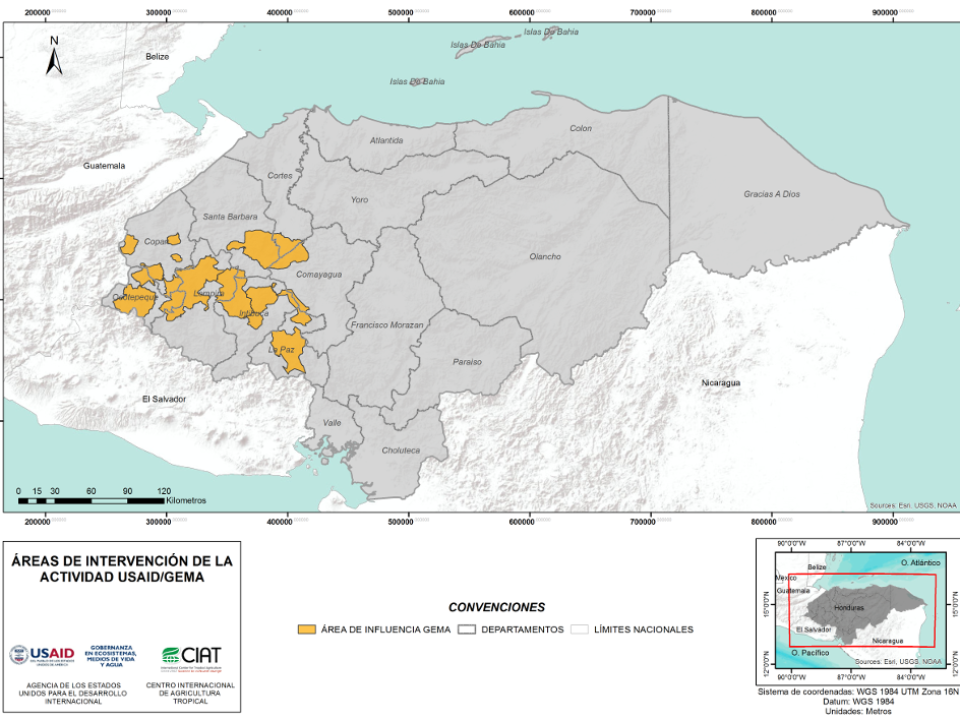

CUANTIFICACIÓN DE LA DEFORESTACIÓN EN LAS ÁREAS DE INTERVENCIÓN DE LA ACTIVIDAD GOBERNANZA EN ECOSISTEMAS, MEDIOS DE VIDA Y AGUA (USAID/GEMA) EN EL OCCIDENTE DE HONDURAS

An international team of scientists*, involving entomologists, conservation biologists, agro-ecologists and geographers, has just revealed how on-farm insect biological control can slow the pace of tropical deforestation and avert biodiversity loss on a macro-scale. The case study concerns biological control of the invasive mealybug Phenacoccus manihoti with the introduced host-specific parasitic wasp Anagyrus lopezi in Southeast Asia. The results of this study have just been published in Communications Biology – Nature.


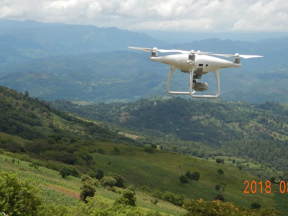
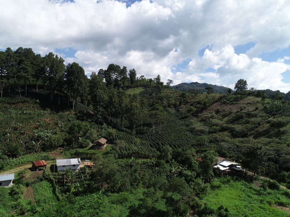
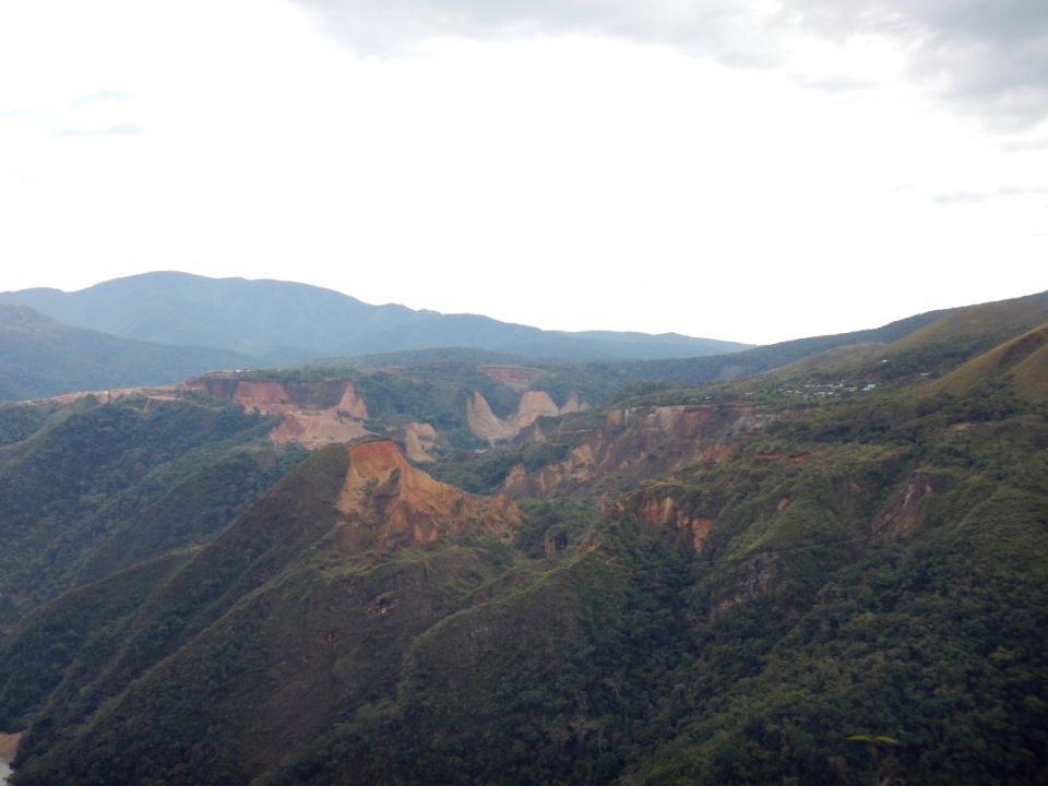
From May 8-12, 2017, the Terra-i team, together with staff from the DGOTA of Peru's Ministry of Environment, carried out the first field validation of vegetative land cover changes detected during Terra-i monitoring for 2016 and 2017, using the technology UAV. This work was carried out under the framework of the project “Sustainable Amazonian Landscapes”. The team carried out over-flights with a Phantom 3 advanced rotor drone and a fixed-wing Ebee drone in seven townships of Yurimaguas. The objective of this work was to recognize the dynamics of land cover and land use changes in the region while at the same time to validate the accuracy of the detections of forest loss being monitored by Terra-i in Yurimaguas.

CIAT and the Terra-i team are pleased to announce the publication of a new study in Paraquaria Natural, the most prestigious journal in Paraguay dedicated to biodiversity and the conservation of nature.


The Terra-i team has worked hard on renovating Terra-i’s website since early this year. A set of new features on the website provides interactive contents and facilitates adaptation to the mobile devices of our users. The fresh website was developed using the latest update of an open-source, Java-based web system, Magnolia CMS 5.4.4. This update was customized to add different categories of interaction such as news, vegetation cover changes, and information, among others.


Globally more than 1 billion people depend on forests for their livelihoods. Forests play a crucial role in climate regulation, ecosystem services provision and regulation, water supply, carbon storage and many other functions that support biodiversity. Currently the global rate of deforestation is substantial, and there is a growing need for timely, spatially explicit data that flag natural vegetation changes due to human activities.
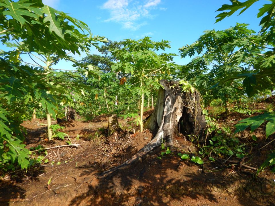

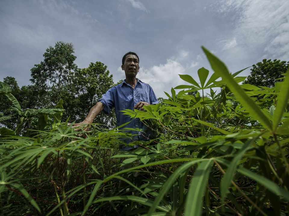
New deforestation hotspots point the finger at my favourite fruit I love Terra-i, but today I hate it. A lot. The system uses satellite images to track deforestation in the Amazon in near-realtime. It’s extremely accurate: if a bunch of trees come down somewhere – no matter how remote – Terra-i picks it up. Cool, right? Not today. CIAT’s Louis Reymondin, the system’s chief architect, dropped the bombshell over coffee: it looks as though hundreds of hectares of rainforest in Peru are being trashed by… papaya.


The latest update of Terra-i has been used with the Co$ting Nature ecosystem services assessment tool to understand the impacts of recent forest loss in Colombia on biodiversity and ecosystem services.

The production of geospatial data related to land-use and land cover changes by governments and civil society organizations has vastly increased during the last decade. Going beyond the valuable information (location, rates and absolute values of changes) provided by these datasets, it is important to have a better understanding of the spatial configurations and composition of the detected change areas at multiple spatial resolutions and time periods. Alejandro Coca-Castro’s research is aiming to map types of spatial deforestation patterns in the Amazon rainforest through the integration of landscape fragmentation metrics and data mining techniques. The research will contribute to the understanding of two deforestation datasets (Terra-i and GFC) and is part of his master dissertation at King’s College London. This blog post highlights Alejandro’s research methodology, preliminary findings and challenges.

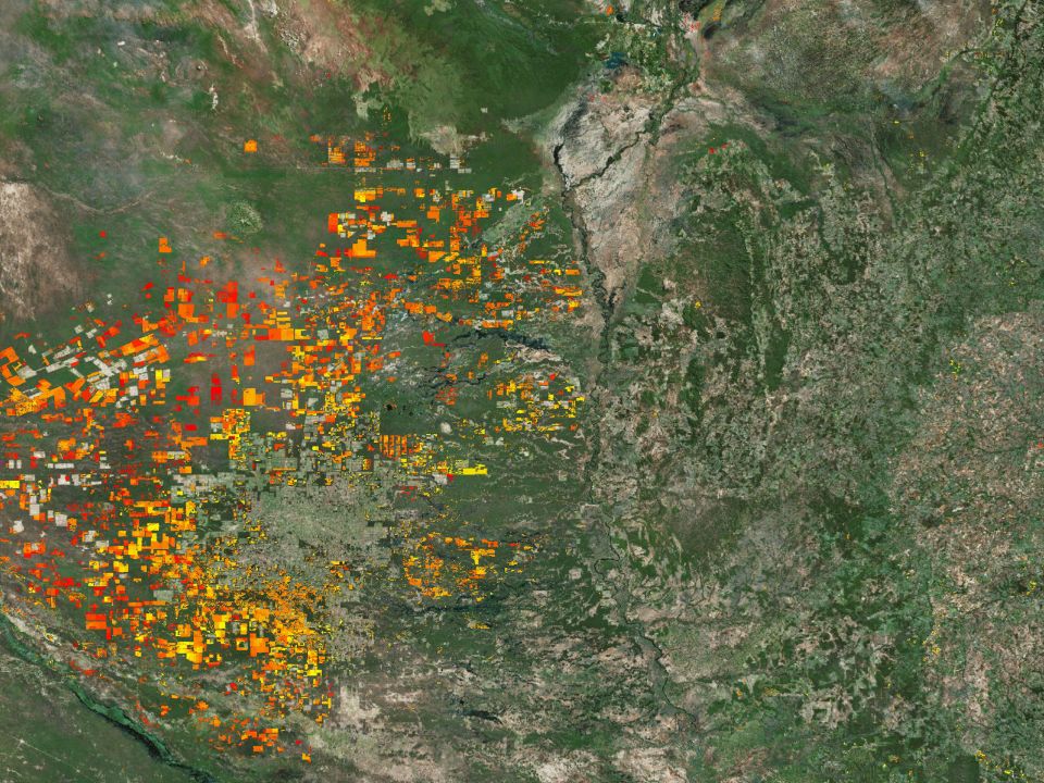
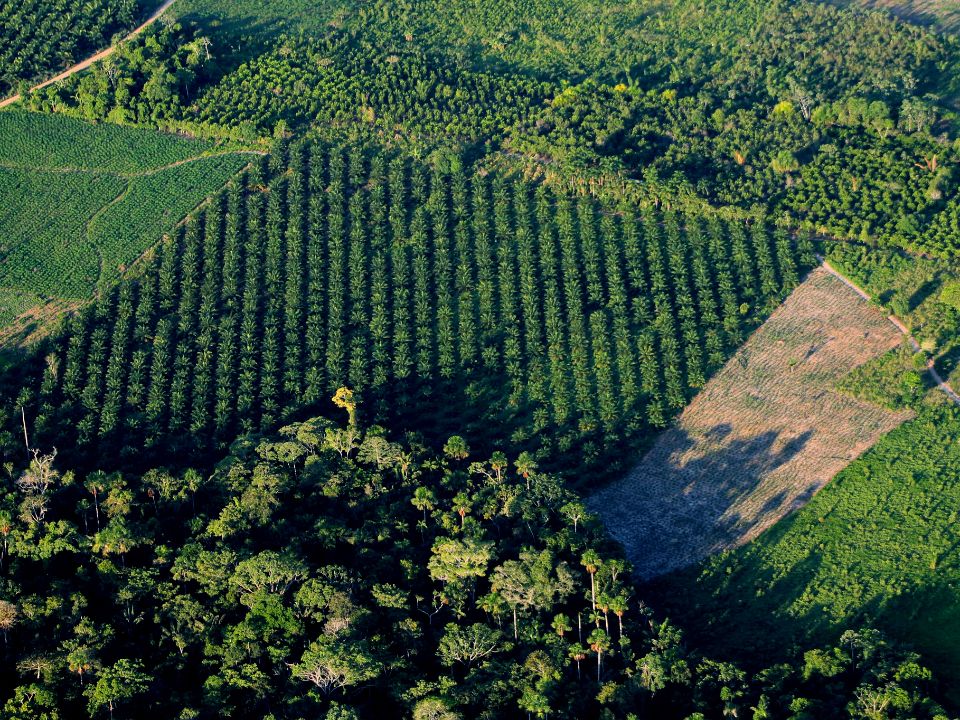
Ecuador is recognized as one of the biodiverse hotspots on earth, underneath the Amazon rainforest lies the country’s oil reservoir. With the oil companies and cleared routes come settlers, therefore more and more of this diverse rainforest is being cut down. Since the oil concerns entered the Ecuadorian Amazon 45 years ago, they keep exploring and exploiting the area. The Terra-i detections reveal a total habitat loss of 87,525 Ha, 16,943 Ha (19%) is part of protected areas, between January 2004 and February 2015.
The Terra-i team together with CRS El Salvador under the Raices project carried out a virtual workshop through the teams platform to technicians from the Ministry of Environment and Natural Resources, CARITAS, Universidad El Salvador, CENTA, about the Mapping of land cover using remote sensors and open source tools such as GEE, SEPAL and QGIS- Plugin Semi Automatic Classification.
Near real-time vegetation loss detection in Southwestern Ethiopia: calibration, validation, and implementation of the Terra-i system
The Alliance of Bioversity International and the International Center for Tropical Agriculture (CIAT) (the Alliance) conducted a training for local stakeholders on the use of Terra-i as part of the collaboration with the Netherlands Development Organisation – SNV in the Coffee Agroforestry and Forest Enhancement for REDD+ (CAFÉ-REDD) Project.
From May 8-12, 2017, the Terra-i team, together with staff from the DGOTA of Peru's Ministry of Environment, carried out the first field validation of vegetative land cover changes detected during Terra-i monitoring for 2016 and 2017, using the technology UAV. This work was carried out under the framework of the project “Sustainable Amazonian Landscapes”. The team carried out over-flights with a Phantom 3 advanced rotor drone and a fixed-wing Ebee drone in seven townships of Yurimaguas. The objective of this work was to recognize the dynamics of land cover and land use changes in the region while at the same time to validate the accuracy of the detections of forest loss being monitored by Terra-i in Yurimaguas.
The Terra-i team has worked hard on renovating Terra-i’s website since early this year. A set of new features on the website provides interactive contents and facilitates adaptation to the mobile devices of our users. The fresh website was developed using the latest update of an open-source, Java-based web system, Magnolia CMS 5.4.4. This update was customized to add different categories of interaction such as news, vegetation cover changes, and information, among others.
Globally more than 1 billion people depend on forests for their livelihoods. Forests play a crucial role in climate regulation, ecosystem services provision and regulation, water supply, carbon storage and many other functions that support biodiversity. Currently the global rate of deforestation is substantial, and there is a growing need for timely, spatially explicit data that flag natural vegetation changes due to human activities.
The latest update of Terra-i has been used with the Co$ting Nature ecosystem services assessment tool to understand the impacts of recent forest loss in Colombia on biodiversity and ecosystem services.
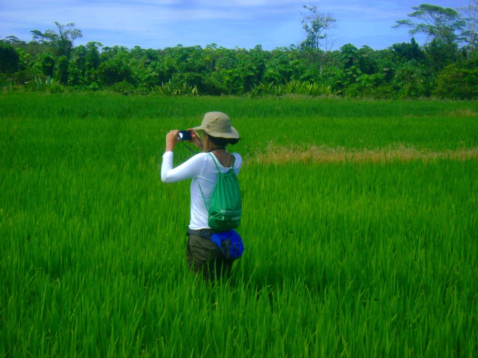

During the 1st and 12th of June 2015, the Terra-i team, together with the Instituto de Investigaciones de la Amazonía Peruana (IIAP) and the Universidad Nacional Agraria La Molina (VLIR-UNALM), conducted the second field validation of the data produced by the Terra-I system. This time, the study area was the Yurimaguas district, Alto Amazonas province, Loreto region (Peru). We used information on populated places, main roads, rivers and information on land cover changes detected for 2013, 2014 and 2015 to define the 65 sampling points (or Terra-I pixels) for the validation process (Figure 1).