
New study shows the value of natural habitat analysis on transportation infrastructure design and planning


CIAT and the Terra-i team are pleased to announce the publication of a new study in Paraquaria Natural, the most prestigious journal in Paraguay dedicated to biodiversity and the conservation of nature.
The study shows the potential indirect impact of the road segment San Juan Nepomuceno-Ruta 6 in Paraguay. It is important to note that this study is a joint effort among the environmental nongovernment organization GUYRA based in Paraguay, the International Center for Tropical Agriculture (CIAT) based in Colombia, and the Inter-American Development Bank (IDB) based in Washington, D.C., USA. This work follows a series of successful collaborations between IDB and CIAT on the topic of road impacts on natural habitats.
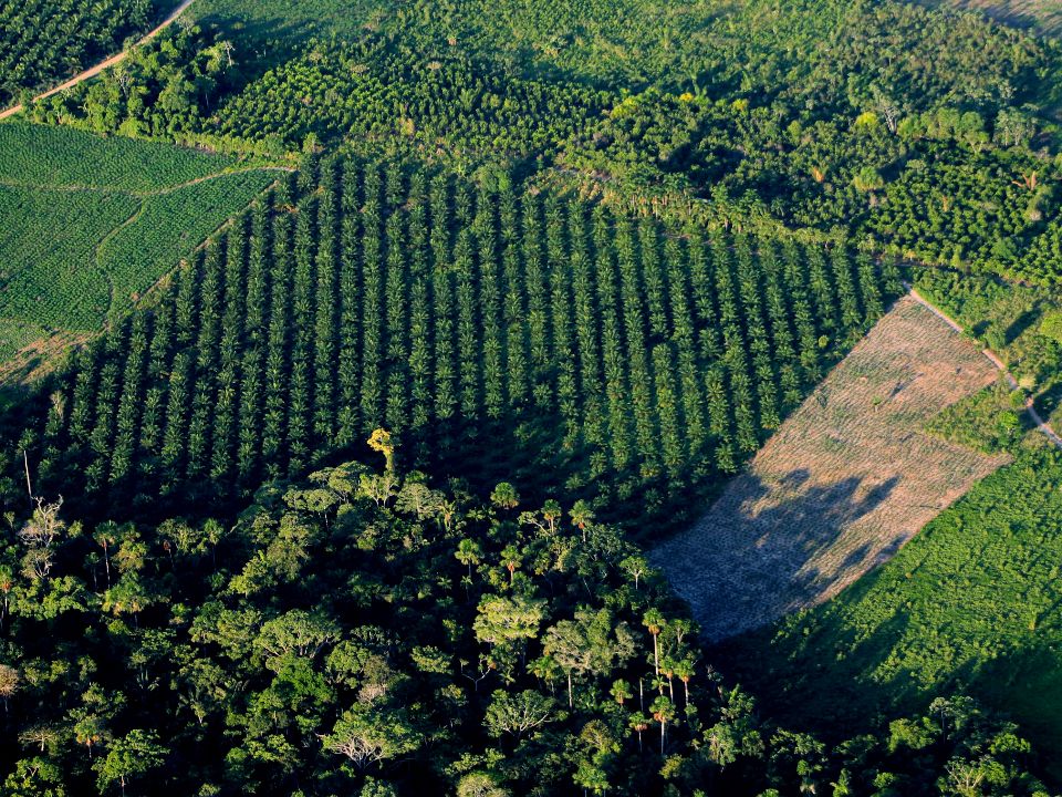
The first collaborative work between CIAT and IDB was conducted with The Nature Conservancy (TNC) and Conservation Biology Institute (CBI), providing tools to analyze the impact of large-scale road projects on natural habitats. That study analyzed the impact of five road infrastructure projects (Figure 1) in Latin America: (1) the Santa Cruz-Puerto Suárez Corridor in Bolivia; (2) the BR-364 Highway in Brazil; (3) the section of the Pan-American Highway in Darién, Panama; (4) the Trans-Chaco Road in Paraguay; and (5) the IIRSA Integration Corridor in Peru. (Read more about that study here: Road Impact Assessment Using Remote Sensing Methodology for Monitoring Land-Use Change in Latin America: Results of Five Case Studies, www.terra-i.org/news/news/Road-Impact-Assessment-in-Latin-America--Results-of-Five-Case-Studies.html.)
In a similar way, a second collaborative study between CIAT and IDB was prepared to determine the potential impacts of road improvement and construction projects in Guyana until 2022. The study clearly suggests that road infrastructure projects (improvement, pavement, and/or construction) can have substantive impacts on land-use change, thus affecting natural habitat extent and leading to increased greenhouse gas emissions. This work was presented at the Sustainable Mega-Infrastructure and Impact Assessment symposium held in Panama in December 2015, organized by the International Association for Impact Assessment (IAIA). (Read more about that study here: Potential Impact of Road Projects on Habitat Loss and Greenhouse Gas Emissions in Guyana from 2012 to 2022 , www.terra-i.org/news/news/What-future-will-Guianan-forests-face-with-upcoming-road-infrastructure-projects-.html , http://conferences.iaia.org/panama/proceedings/Indirect_IA_of_the_Road_Segment.pdf.)
![]()
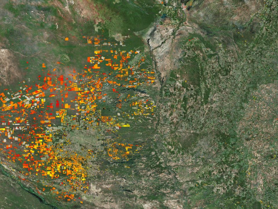
Figure 1 map of risk of deforestation
This third and new study analyzes the past, current, and potential future deforestation resulting from the improvement of the road segment between San Juan Nepomuceno and Route 6 (PR-L1080) in southeastern Paraguay. The deforestation baseline in the study area was defined using Landsat imagery from 1987 to 2014. Using this baseline and additional datasets, a map of deforestation risk was developed at the national scale and then applied in the area of influence of the road studied.
The results of the baseline analysis, performed by GUYRA, show that, between 1987 and 2014, about 215,000 hectares of native forest were lost in the direct area of influence of the road, before the improvement of the road that is planned to occur in 2017. From the data produced, it is possible to estimate the impact of the introduction of the “zero deforestation” law in 2004 as the rate of deforestation decreased sharply between 2005 and 2010. However, the deforestation trend increased again between 2010 and 2014.
The analysis of the maps of deforestation risk, performed by CIAT, shows that the road improvement project would potentially increase deforestation in the area by 1.41% by 2023 if no protected area enforcement is implemented, which is equivalent to 15,603 hectares.
In contrast, if good support is provided to protected areas and assuming the deforestation trends are similar to the ones observed between 2010 and 2014, deforestation would potentially increase by only 1.11%.
Nonetheless, a potential low impact of the road improvement, such as the one predicted above, could simply mean that most deforestation already occurred in the past decades and that there is little forest to convert in the study area, which is still under high risk of deforestation because of several other factors (Figure 1).
These findings clearly identify road infrastructure projects (improvement, pavement, and construction) as a deforestation enabler with strong indirect impacts on natural ecosystems. They reconfirm the importance of not only ex ante and detailed environmental impact assessments that should accompany any infrastructure project but also national and local policies aimed at discouraging deforestation and promoting compensation and habitat protection schemes, especially in areas known as important carbon sinks and essential for biodiversity conservation.
In this particular case in Paraguay, IDB strongly supports the implementation of compensation schemes, including the purchase of certificates under the new law of Payment for Environmental Services. IDB will also support the consolidation of protected areas, the restoration of biological corridors, implementation of fauna crossings, and reforestation of headwaters and eroded areas along the right of way in close cooperation with local and national stakeholders. In this way, this initiative will make this road project a first example of sustainable road infrastructure in Paraguay.
For more details, see the full paper here: http://guyra.org.py/download/paraquaria-junio-2016/.


The Terra-i team together with CRS El Salvador under the Raices project carried out a virtual workshop through the teams platform to technicians from the Ministry of Environment and Natural Resources, CARITAS, Universidad El Salvador, CENTA, about the Mapping of land cover using remote sensors and open source tools such as GEE, SEPAL and QGIS- Plugin Semi Automatic Classification.


Near real-time vegetation loss detection in Southwestern Ethiopia: calibration, validation, and implementation of the Terra-i system


The Alliance of Bioversity International and the International Center for Tropical Agriculture (CIAT) (the Alliance) conducted a training for local stakeholders on the use of Terra-i as part of the collaboration with the Netherlands Development Organisation – SNV in the Coffee Agroforestry and Forest Enhancement for REDD+ (CAFÉ-REDD) Project.


IDENTIFICACIÓN DE CAUSAS DE PÉRDIDA DE COBERTURA VEGETAL EN LAS ÁREAS DE INTERVENCIÓN DE LA ACTIVIDAD GOBERNANZA EN ECOSISTEMAS, MEDIOS DE VIDA Y AGUA (USAID/GEMA) EN EL OCCIDENTE DE HONDURAS

MAPEO DE COBERTURAS DE LA TIERRA PARA EL 2017, EN EL OCCIDENTE HONDUREÑO SOBRE ÁREAS DE INTERVENCIÓN DE LA ACTIVIDAD GOBERNANZA EN ECOSISTEMAS, MEDIOS DE VIDA Y AGUA (USAID/GEMA)
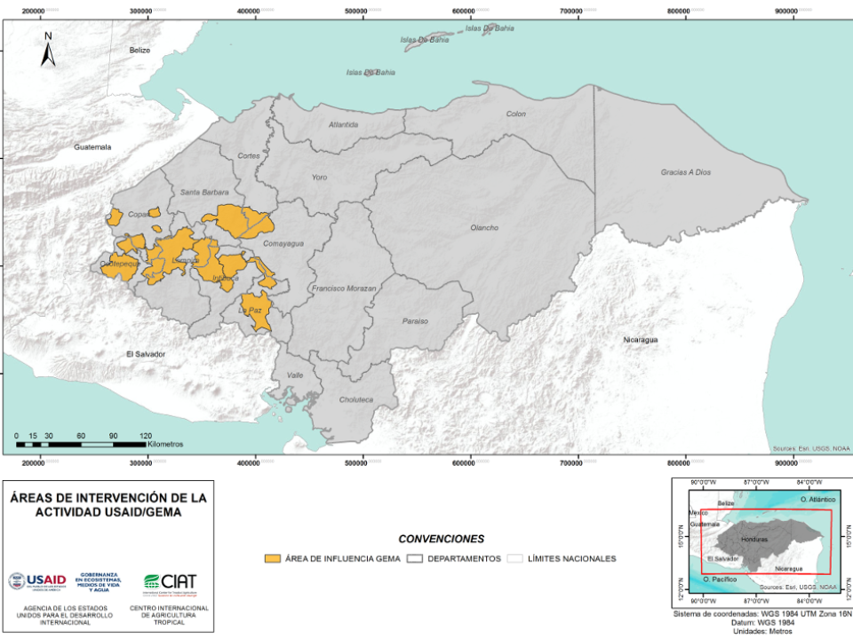

CUANTIFICACIÓN DE LA DEFORESTACIÓN EN LAS ÁREAS DE INTERVENCIÓN DE LA ACTIVIDAD GOBERNANZA EN ECOSISTEMAS, MEDIOS DE VIDA Y AGUA (USAID/GEMA) EN EL OCCIDENTE DE HONDURAS
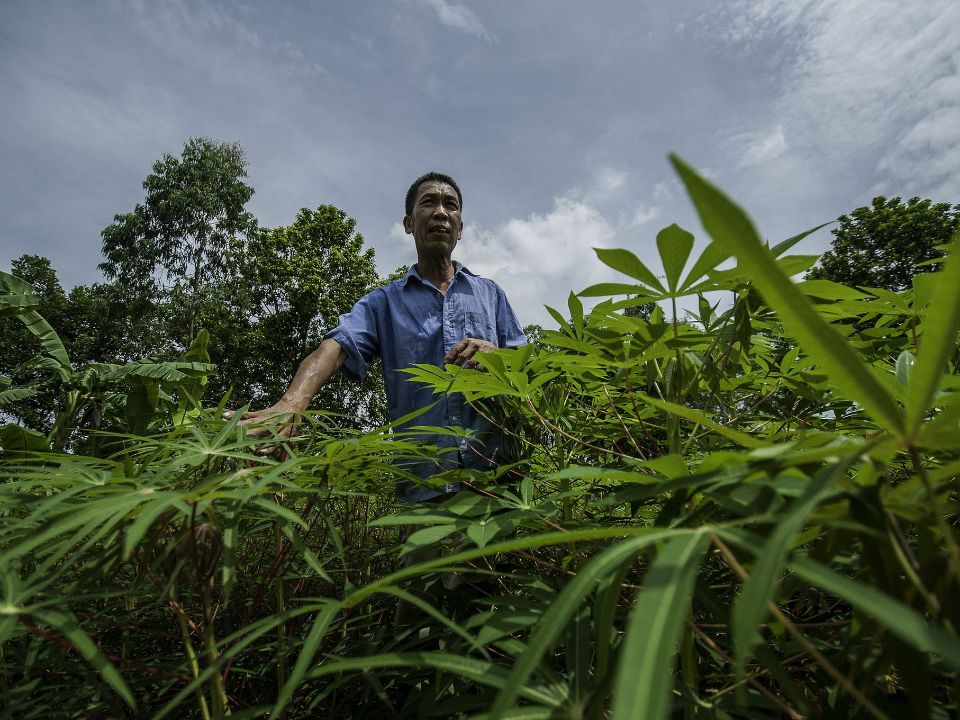

An international team of scientists*, involving entomologists, conservation biologists, agro-ecologists and geographers, has just revealed how on-farm insect biological control can slow the pace of tropical deforestation and avert biodiversity loss on a macro-scale. The case study concerns biological control of the invasive mealybug Phenacoccus manihoti with the introduced host-specific parasitic wasp Anagyrus lopezi in Southeast Asia. The results of this study have just been published in Communications Biology – Nature.


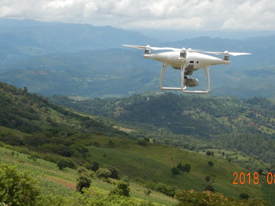
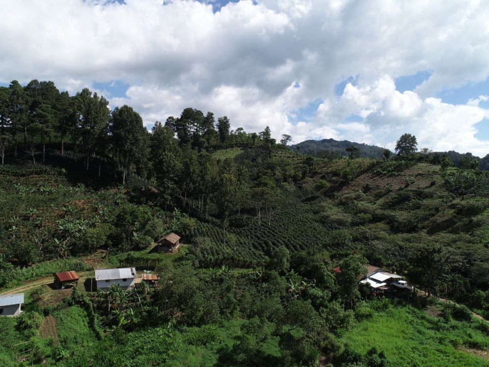
From May 8-12, 2017, the Terra-i team, together with staff from the DGOTA of Peru's Ministry of Environment, carried out the first field validation of vegetative land cover changes detected during Terra-i monitoring for 2016 and 2017, using the technology UAV. This work was carried out under the framework of the project “Sustainable Amazonian Landscapes”. The team carried out over-flights with a Phantom 3 advanced rotor drone and a fixed-wing Ebee drone in seven townships of Yurimaguas. The objective of this work was to recognize the dynamics of land cover and land use changes in the region while at the same time to validate the accuracy of the detections of forest loss being monitored by Terra-i in Yurimaguas.


The Terra-i team has worked hard on renovating Terra-i’s website since early this year. A set of new features on the website provides interactive contents and facilitates adaptation to the mobile devices of our users. The fresh website was developed using the latest update of an open-source, Java-based web system, Magnolia CMS 5.4.4. This update was customized to add different categories of interaction such as news, vegetation cover changes, and information, among others.


Globally more than 1 billion people depend on forests for their livelihoods. Forests play a crucial role in climate regulation, ecosystem services provision and regulation, water supply, carbon storage and many other functions that support biodiversity. Currently the global rate of deforestation is substantial, and there is a growing need for timely, spatially explicit data that flag natural vegetation changes due to human activities.
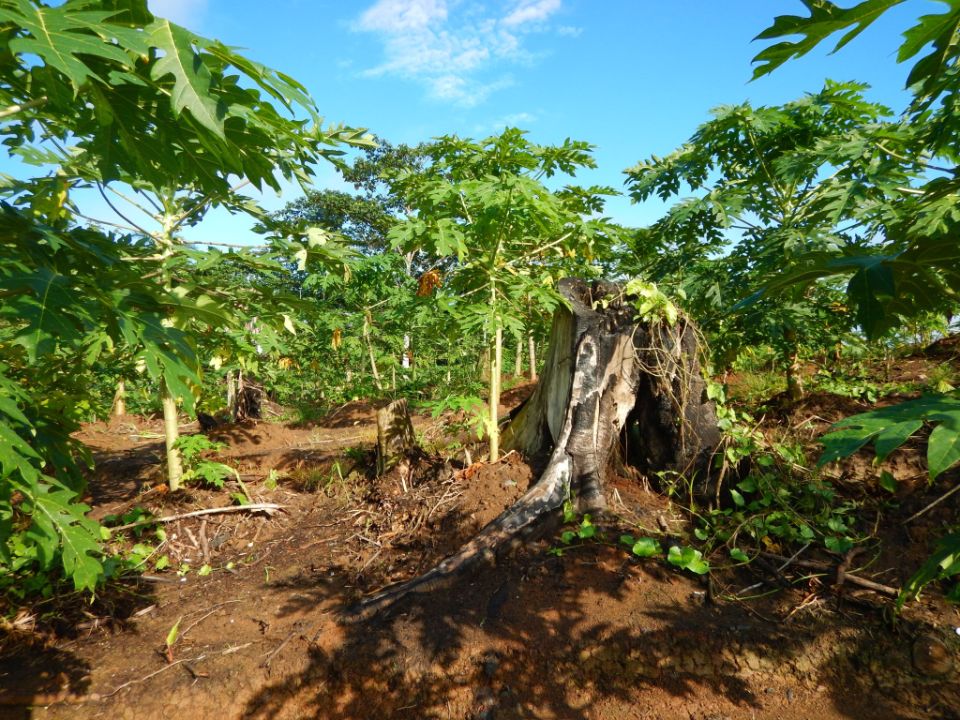

New deforestation hotspots point the finger at my favourite fruit I love Terra-i, but today I hate it. A lot. The system uses satellite images to track deforestation in the Amazon in near-realtime. It’s extremely accurate: if a bunch of trees come down somewhere – no matter how remote – Terra-i picks it up. Cool, right? Not today. CIAT’s Louis Reymondin, the system’s chief architect, dropped the bombshell over coffee: it looks as though hundreds of hectares of rainforest in Peru are being trashed by… papaya.


The latest update of Terra-i has been used with the Co$ting Nature ecosystem services assessment tool to understand the impacts of recent forest loss in Colombia on biodiversity and ecosystem services.

The production of geospatial data related to land-use and land cover changes by governments and civil society organizations has vastly increased during the last decade. Going beyond the valuable information (location, rates and absolute values of changes) provided by these datasets, it is important to have a better understanding of the spatial configurations and composition of the detected change areas at multiple spatial resolutions and time periods. Alejandro Coca-Castro’s research is aiming to map types of spatial deforestation patterns in the Amazon rainforest through the integration of landscape fragmentation metrics and data mining techniques. The research will contribute to the understanding of two deforestation datasets (Terra-i and GFC) and is part of his master dissertation at King’s College London. This blog post highlights Alejandro’s research methodology, preliminary findings and challenges.

Ecuador is recognized as one of the biodiverse hotspots on earth, underneath the Amazon rainforest lies the country’s oil reservoir. With the oil companies and cleared routes come settlers, therefore more and more of this diverse rainforest is being cut down. Since the oil concerns entered the Ecuadorian Amazon 45 years ago, they keep exploring and exploiting the area. The Terra-i detections reveal a total habitat loss of 87,525 Ha, 16,943 Ha (19%) is part of protected areas, between January 2004 and February 2015.
IDENTIFICACIÓN DE CAUSAS DE PÉRDIDA DE COBERTURA VEGETAL EN LAS ÁREAS DE INTERVENCIÓN DE LA ACTIVIDAD GOBERNANZA EN ECOSISTEMAS, MEDIOS DE VIDA Y AGUA (USAID/GEMA) EN EL OCCIDENTE DE HONDURAS
MAPEO DE COBERTURAS DE LA TIERRA PARA EL 2017, EN EL OCCIDENTE HONDUREÑO SOBRE ÁREAS DE INTERVENCIÓN DE LA ACTIVIDAD GOBERNANZA EN ECOSISTEMAS, MEDIOS DE VIDA Y AGUA (USAID/GEMA)
CUANTIFICACIÓN DE LA DEFORESTACIÓN EN LAS ÁREAS DE INTERVENCIÓN DE LA ACTIVIDAD GOBERNANZA EN ECOSISTEMAS, MEDIOS DE VIDA Y AGUA (USAID/GEMA) EN EL OCCIDENTE DE HONDURAS
An international team of scientists*, involving entomologists, conservation biologists, agro-ecologists and geographers, has just revealed how on-farm insect biological control can slow the pace of tropical deforestation and avert biodiversity loss on a macro-scale. The case study concerns biological control of the invasive mealybug Phenacoccus manihoti with the introduced host-specific parasitic wasp Anagyrus lopezi in Southeast Asia. The results of this study have just been published in Communications Biology – Nature.
New deforestation hotspots point the finger at my favourite fruit I love Terra-i, but today I hate it. A lot. The system uses satellite images to track deforestation in the Amazon in near-realtime. It’s extremely accurate: if a bunch of trees come down somewhere – no matter how remote – Terra-i picks it up. Cool, right? Not today. CIAT’s Louis Reymondin, the system’s chief architect, dropped the bombshell over coffee: it looks as though hundreds of hectares of rainforest in Peru are being trashed by… papaya.
The production of geospatial data related to land-use and land cover changes by governments and civil society organizations has vastly increased during the last decade. Going beyond the valuable information (location, rates and absolute values of changes) provided by these datasets, it is important to have a better understanding of the spatial configurations and composition of the detected change areas at multiple spatial resolutions and time periods. Alejandro Coca-Castro’s research is aiming to map types of spatial deforestation patterns in the Amazon rainforest through the integration of landscape fragmentation metrics and data mining techniques. The research will contribute to the understanding of two deforestation datasets (Terra-i and GFC) and is part of his master dissertation at King’s College London. This blog post highlights Alejandro’s research methodology, preliminary findings and challenges.
Ecuador is recognized as one of the biodiverse hotspots on earth, underneath the Amazon rainforest lies the country’s oil reservoir. With the oil companies and cleared routes come settlers, therefore more and more of this diverse rainforest is being cut down. Since the oil concerns entered the Ecuadorian Amazon 45 years ago, they keep exploring and exploiting the area. The Terra-i detections reveal a total habitat loss of 87,525 Ha, 16,943 Ha (19%) is part of protected areas, between January 2004 and February 2015.