
Terra-i participates in fieldwork in Puno, Peru


Between September 28th and October 1th, 2015, Jhon Tello from Terra-i team, participated in the fieldwork in the department of Puno, Peru, organized by the Directorate General of Land Management DGOT - MINAM.
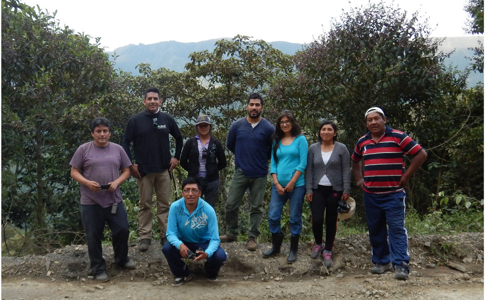
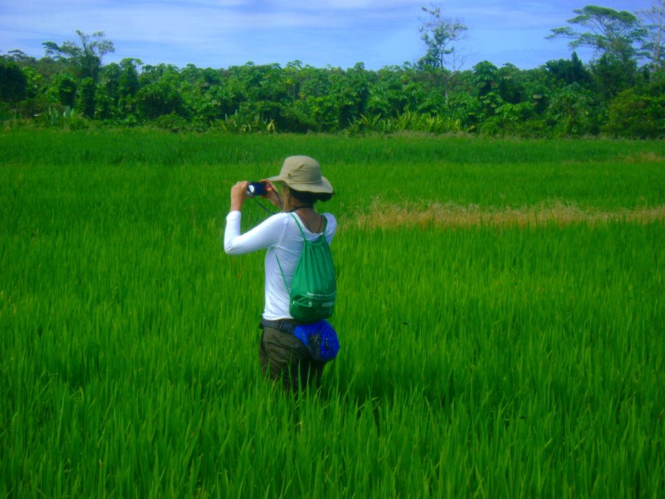
Fieldwork team
The field activities were directed by Germán Marchand, Witman Garcia and Angelica Sauñe, specialists from the Directorate General of Land Management DGOT - MINAM in coordination with the Regional Government of Puno - Regional Management of Natural Resources and Environmental Management - Project Planning territorial, specialists Yaneth De la Cruz Mamani y Yessica Quenta Gutiérrez, Perú. This work had as objective to perform activities of geographical reconnaissance and verification of results of changing land cover in the province of Sandia, districts of Alto Inambari and Phara, in the Puno department, as well as areas of Puno, Juliaca and Huancané. The specific objectives, focused on the verification of results of technological tools, which are based on visual and digital interpretation of satellite images. These are used to analyze changes in land cover as its main contribution to the system of early detection and environmental monitoring of areas degraded by illegal and informal mining.
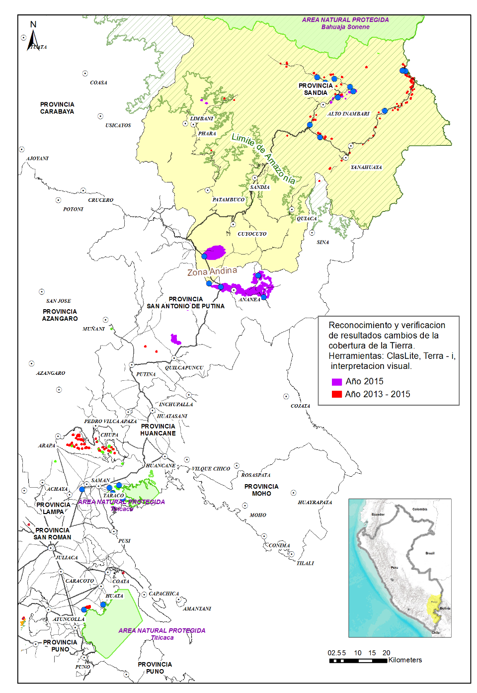
Points related to changes in land cover (10 points, CLASLite), changes in coverage by mining (10 points, visual interpretation) and changes in vegetation cover (10 points, Terra - i) Source: DGOT - MINAM
On the basis of a set of sampling points distributed over the work area and supported by the Protocolo de levantamiento de información de campo para reconocimiento y verificación cartografía sobre cambios en la cobertura de la tierra, developed by the DGOT - MINAM. The team visited points for recognition of illegal and informal mining activity related to changes of Terra-i, ClasLite and points of change based on visual interpretation. In each visited point a form field information was recorded with coordinates, height, photographs in the four cardinal points, class of use and coverage, among others. Additionally some points of interest associated with anthropogenic interventions were recorded during the journey.
Terra-i
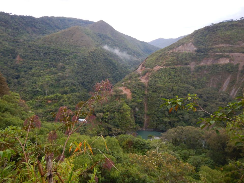
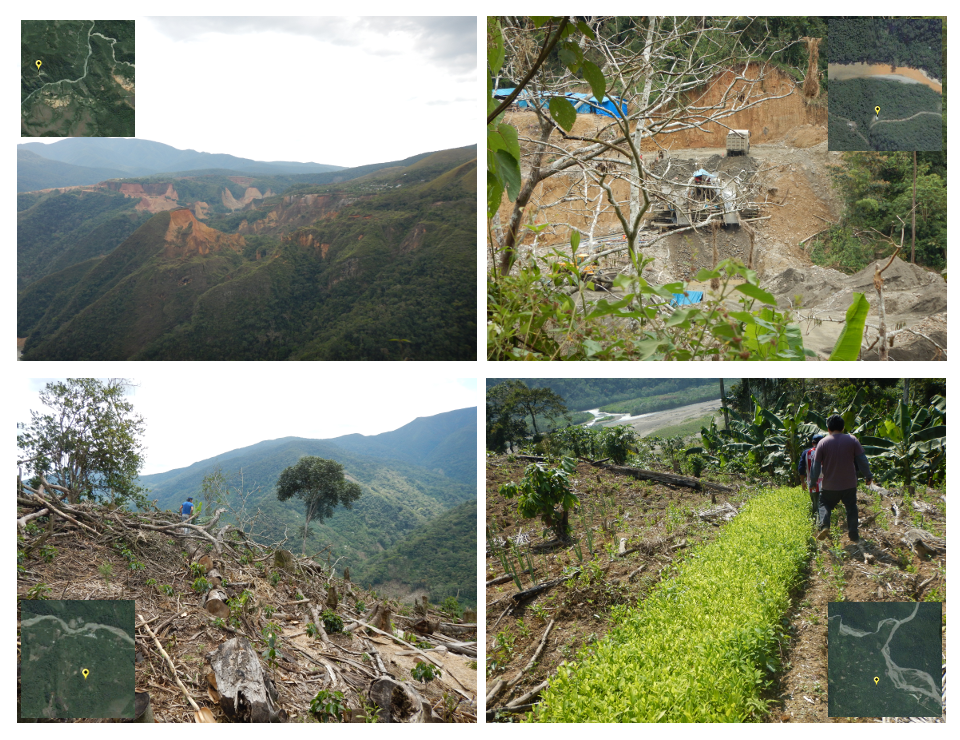
The fieldwork was realized by land route. The points, which could be observed from the road, were primarily engaged in changes due to informal mining. The presence of dredgers and specialized machinery dedicated to mining was quite evident along the river Huari Huari, between the province of Sandia, Alto Inambari district and San Juan del Oro area. In points located between San Juan del Oro and the District of San Pedro de Putina Punco, crops such as coffee, cassava, citrus and coca were mainly found. In two points located in the district of Taraco province of Huancané alfalfa crops, forage oats and land in preparation for crops were identified.
These works are carried out under the policy framework endorsed by the Ministry of Environment of Peru and are part of the operational plans of the General Directorate of Land Management - DGOT.
The Terra-i team is grateful to the members of the General Directorate of Land Management - DGOT for the invitation to be part of this fieldwork. This experience is important to improve our knowledge in field validation and calibration of our system input.
see photo gallery https://www.flickr.com/photos/terra-i/albums/72157659594386241


The Terra-i team together with CRS El Salvador under the Raices project carried out a virtual workshop through the teams platform to technicians from the Ministry of Environment and Natural Resources, CARITAS, Universidad El Salvador, CENTA, about the Mapping of land cover using remote sensors and open source tools such as GEE, SEPAL and QGIS- Plugin Semi Automatic Classification.


Near real-time vegetation loss detection in Southwestern Ethiopia: calibration, validation, and implementation of the Terra-i system


The Alliance of Bioversity International and the International Center for Tropical Agriculture (CIAT) (the Alliance) conducted a training for local stakeholders on the use of Terra-i as part of the collaboration with the Netherlands Development Organisation – SNV in the Coffee Agroforestry and Forest Enhancement for REDD+ (CAFÉ-REDD) Project.


From May 8-12, 2017, the Terra-i team, together with staff from the DGOTA of Peru's Ministry of Environment, carried out the first field validation of vegetative land cover changes detected during Terra-i monitoring for 2016 and 2017, using the technology UAV. This work was carried out under the framework of the project “Sustainable Amazonian Landscapes”. The team carried out over-flights with a Phantom 3 advanced rotor drone and a fixed-wing Ebee drone in seven townships of Yurimaguas. The objective of this work was to recognize the dynamics of land cover and land use changes in the region while at the same time to validate the accuracy of the detections of forest loss being monitored by Terra-i in Yurimaguas.


The Terra-i team has worked hard on renovating Terra-i’s website since early this year. A set of new features on the website provides interactive contents and facilitates adaptation to the mobile devices of our users. The fresh website was developed using the latest update of an open-source, Java-based web system, Magnolia CMS 5.4.4. This update was customized to add different categories of interaction such as news, vegetation cover changes, and information, among others.


Globally more than 1 billion people depend on forests for their livelihoods. Forests play a crucial role in climate regulation, ecosystem services provision and regulation, water supply, carbon storage and many other functions that support biodiversity. Currently the global rate of deforestation is substantial, and there is a growing need for timely, spatially explicit data that flag natural vegetation changes due to human activities.


The latest update of Terra-i has been used with the Co$ting Nature ecosystem services assessment tool to understand the impacts of recent forest loss in Colombia on biodiversity and ecosystem services.

During the 1st and 12th of June 2015, the Terra-i team, together with the Instituto de Investigaciones de la Amazonía Peruana (IIAP) and the Universidad Nacional Agraria La Molina (VLIR-UNALM), conducted the second field validation of the data produced by the Terra-I system. This time, the study area was the Yurimaguas district, Alto Amazonas province, Loreto region (Peru). We used information on populated places, main roads, rivers and information on land cover changes detected for 2013, 2014 and 2015 to define the 65 sampling points (or Terra-I pixels) for the validation process (Figure 1).