
New CartoChaco platform: Geo-journalism to raise awareness of the pressures on South America’s Gran Chaco region


CartoChaco, a new web-based knowledge platform dedicated to the Gran Chaco region, was launched on 28 July in Asuncion, Paraguay.
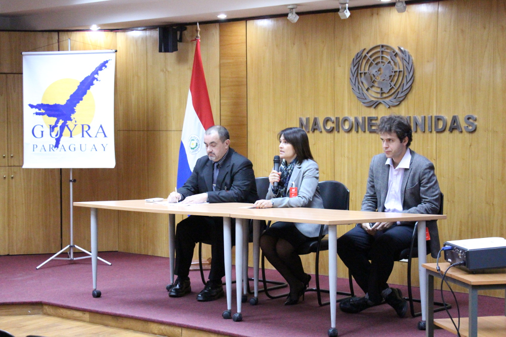
Figure 1. From left to right: Dr. Alberto Yanoski (Executive Director of Guyra), Ms. María Cristina Morales Palarea (Minister of Environment of Paraguay) and Gustavo Faleiros (Infoamazonia).
The Chaco, which is divided among Bolivia, Paraguay, Argentina and Brazil, is considered one of the most important bioregions on the planet due to its high diversity of endemic fauna and flora. The Chaco also contributes significantly to the operation and regulation of one of the largest river basins in the world, “El Rio de la Plata”. However, increasing disturbances from human activities, in particular commercial agriculture, have caused one of the highest rates of natural vegetation loss at global scale, affecting especially dry forests.
CartoChaco is the result of a partnership between Guyra/Paraguay, InfoAmazonia and Terra-i/CIAT, and was created to raise awareness of the threats to natural habitats in this rich bioregion. The platform uses multiple geo-technologies and provides easy access to relevant events and research carried in the Chaco, especially in the form of user-friendly thematic maps and visualizations of data (using MapBox), monthly reports of natural vegetation changes provided by Guyra and Terra-i, as well as geo-tagged new stories.
The launch took place at the United Nations offices in Asuncion, Paraguay and was attended by the Minister of Environment of Paraguay, Ms. Maria Cristina Morales Palarea, Paraguayan Senator, Fernando Silva Facetti, and the Executive Director of Guyra, Alberto Yanoski. The launch also counted with the participation of representatives from various organizations such as UNDP, IDB, itaú Foundation, the Environment Secretary, Comptroller General of the Republic, INFONA, Attorney General, WWF, WCS, PNUMA-ONU REDD, FACEN-UNA, Public Ministry, Avina, Institute of Development, among others.
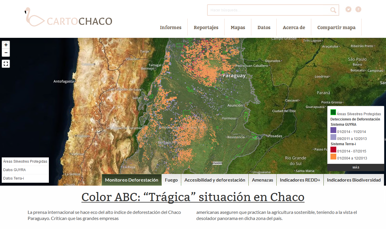
Figure 2. Example of shared map about Deforestation and Protected Areas provided by Carto Chaco web portal.
Six interactive maps were made available on the platform and presented on the occasion of the launch, led by Gustavo Faleiros of InfoAmazonia, including: Deforestation Monitoring, Fires, Accessibility and Deforestation, Biodiversity Indicators, REDD+ Indicators and Threats. Other features of the website such as the geo-referenced stories, reports, map data description, and options for sharing maps and publishing news stories were also showed. CartoChaco’s partners, Guyra, Infoamazonia, Simgia and Terra-i, then presented the latest advances in their respective field of work.
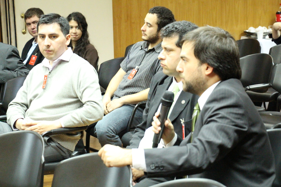
Figure 3. As part of the launch, a discussion session between the participants provided feedback for present and future developments of the platform.
Finally, a round-table moderated by Enrique Bragayrac (Guyra) and discussions with the participants allowed to gather opinions and feedback on the platform, its strengths and weaknesses, possible future developments, and relevant data to be shared. Participants in particular suggested to include a social component as a way to attract more participation from the community.
The Carto Chaco initiative has been made possible thanks to the financial support of the Earth Journalism Network, member of Internews (an international NGO), and CIAT (through the CGIAR Research Program on Forests, Trees and Agroforestry - FTA). Maps providers including The Nature Conservancy and King’s College London have also been essential for this launch. To date, Carto Chaco has a multidisciplinary team of researchers, cartographers, developers and journalists. Our goal in the future is to increase the number of people involved, creating a community of experts, media and citizens for the Gran Chaco conservation.
Are you interested to check out the video recording and presentations of this event? Click on the following links:
View video: https://youtu.be/-2o0XW9HLu8
Presentations: http://bit.ly/1AUBCCk
The Terra-i team, on behalf of CIAT, wishes to thank GUYRA for hosting this event, especially its Executive Director, Dr. Alberto Yanoski, and staff members, Romina Cardozo, Fabiana Arévalos, Fernando Palacios and Jazmin Caballero. We also thank Gustavo Faleiros’s team at Infoamazonia as well as Javier Cardozo and Jose Gonzalez from Simgia for their valuable contributions in the development of this project and the successful realization of the launch of the initiative www.cartochaco.org.
Blog post by Jhon Tello. Revision of English-language version by Stephanie Neno (CIAT’s communications officer).


The Terra-i team together with CRS El Salvador under the Raices project carried out a virtual workshop through the teams platform to technicians from the Ministry of Environment and Natural Resources, CARITAS, Universidad El Salvador, CENTA, about the Mapping of land cover using remote sensors and open source tools such as GEE, SEPAL and QGIS- Plugin Semi Automatic Classification.


Near real-time vegetation loss detection in Southwestern Ethiopia: calibration, validation, and implementation of the Terra-i system


The Alliance of Bioversity International and the International Center for Tropical Agriculture (CIAT) (the Alliance) conducted a training for local stakeholders on the use of Terra-i as part of the collaboration with the Netherlands Development Organisation – SNV in the Coffee Agroforestry and Forest Enhancement for REDD+ (CAFÉ-REDD) Project.


From May 8-12, 2017, the Terra-i team, together with staff from the DGOTA of Peru's Ministry of Environment, carried out the first field validation of vegetative land cover changes detected during Terra-i monitoring for 2016 and 2017, using the technology UAV. This work was carried out under the framework of the project “Sustainable Amazonian Landscapes”. The team carried out over-flights with a Phantom 3 advanced rotor drone and a fixed-wing Ebee drone in seven townships of Yurimaguas. The objective of this work was to recognize the dynamics of land cover and land use changes in the region while at the same time to validate the accuracy of the detections of forest loss being monitored by Terra-i in Yurimaguas.


The Terra-i team has worked hard on renovating Terra-i’s website since early this year. A set of new features on the website provides interactive contents and facilitates adaptation to the mobile devices of our users. The fresh website was developed using the latest update of an open-source, Java-based web system, Magnolia CMS 5.4.4. This update was customized to add different categories of interaction such as news, vegetation cover changes, and information, among others.


Globally more than 1 billion people depend on forests for their livelihoods. Forests play a crucial role in climate regulation, ecosystem services provision and regulation, water supply, carbon storage and many other functions that support biodiversity. Currently the global rate of deforestation is substantial, and there is a growing need for timely, spatially explicit data that flag natural vegetation changes due to human activities.


The latest update of Terra-i has been used with the Co$ting Nature ecosystem services assessment tool to understand the impacts of recent forest loss in Colombia on biodiversity and ecosystem services.

During the 1st and 12th of June 2015, the Terra-i team, together with the Instituto de Investigaciones de la Amazonía Peruana (IIAP) and the Universidad Nacional Agraria La Molina (VLIR-UNALM), conducted the second field validation of the data produced by the Terra-I system. This time, the study area was the Yurimaguas district, Alto Amazonas province, Loreto region (Peru). We used information on populated places, main roads, rivers and information on land cover changes detected for 2013, 2014 and 2015 to define the 65 sampling points (or Terra-I pixels) for the validation process (Figure 1).