Our team
Andy Jarvis
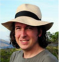
Dr. Andy Jarvis is the Leader of the Decision and Policy Analysis Program in the International Centre for Tropical Agriculture (CIAT) and is a Theme Leader on the CGIAR Research Program for Climate Change, Agriculture and Food Security, based in Cali, Colombia. Dr. Jarvis has 10 years experience of cutting edge scientific research in developing countries to support the goals of alleviating poverty and protecting essential ecosystem services of importance to humanity. His research has focused on the use of spatial analysis and environmental modeling to address issues such as agricultural biodiversity conservation, adaptation to climate change, and maintenance of ecosystem services. Over the past ten years Dr. Jarvis has published over 50 articles, book chapters or books, with over 20 of these in peer-reviewed articles published in international journals. Dr. Jarvis has also worked as a consultant to the Food and Agriculture Organisation (FAO) on developing climate change strategies to conserve agricultural biodiversity, and been a consultant on a variety of projects for the European Union, Global Environment Facility amongst others. In 2003 Dr. Jarvis won the Crop Science Society of America (CSSA) C-8 Genetic Resources award for best research paper stemming from his work on conservation prioritization research for wild peanuts in Latin America, and in 2009 received the prestigious Ebbe Nielsen award for innovative research in bioinformatics and biosystematics.
Jerome Touval
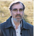 Jerome Touval is the Regional Science Director for Latin America at the Nature Conservancy (TNC). He has over 10 years of experience on key conservation issues. His work focuses on ensuring a consistent approach to conservation science across the regional program, sharing of best practices among staff, and focusing on generating the highest priority science required to address conservation management questions and decision-making. He also works with other conservation groups, government agencies and research institutions to identify priority areas for conservation, large-scale threats to biodiversity and opportunities for conservation.
Louis Reymondin
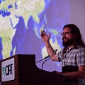 Louis Reymondin is an expert in software development to combine big and georeferenced data. He did his undergraduate in software development at University of Applied Sciences Western Switzerland and did his PhD in Geography at King’s College London. Louis’ PhD research focused on the development and implementation of Terra-i: an early warning system to monitor changes in habitat throughout Latin America. Louis has about 10 years of experience in coordinating the Terra-i project and researches involving the use of artificial intelligence and data mining to better understand the dynamics between human activities and the environment.
Andres Perez Uribe
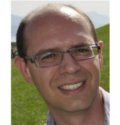 Andres Perez-Uribe was born in 1971. He received a diploma in Electrical Engineering from the Universidad del Valle, Cali, Colombia, in 1993. He arrived in Switzerland in 1994 with a Swiss government fellowship and pursued research work with Professors Eduardo Sanchez and Daniel Mange at the Logic Systems Laboratory, Computer Science Department of the EPFL in the domain of artificial neural networks, autonomous mobile robotics, and reconfigurable circuits. He received a PhD degree in computer science from the EPFL in 1999 after completing his thesis on "Structure-adaptable Digital Neural Networks". In 2003 he became professor at the University of Applied Sciences of Western Switzerland (HEIG-VD / HES-SO). At HEIG-VD, he has taught courses on computer architecture, digital systems, bio-inspired systems, smart devices, machine intelligence, and has participated in the program Future Ingénieure, Egalité-HEIG-VD. He has participated as a lecturer on the Social psychology and Neurosciences doctoral schools of the Universities of Geneva and Lausanne, and is currently involved in several international research projects. He collaborates with the International Center for Tropical Agriculture (CIAT) in the development of Terra-i.
Mark Mulligan
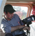 Mark Mulligan is Reader in Geography in the Environmental Monitoring, Modelling research group of the Department of Geography of King’s College London, UK. He has supervised some 21 PhD students and has a further 10 current PhD students including Louis Reymondin, all of whom work in policy-relevant environmental research. His research interests are in the application of environmental GIS, remote sensing and modelling to policy problems in water, agriculture and conservation. He has worked on these issues in the tropics since 1994 with funding from a range of sources and has published widely on these topics. During this time is has developed a series of widely used geo-databases (http://www.kcl.ac.uk/geodata) and policy support systems (http://www.policysupport.org) to facilitate robust and effective policy-making in ecosystem services and water resources management.
Alejandro Coca
 Alejandro is an Agronomist graduated from Universidad Nacional de Colombia with a MSc. in Environmental Monitoring, Modelling and Management at King’s College London. He has supported the Terra-i project since 2011 as intern, research assistant and visiting researcher. He is currently continuing a closely work with the Terra-i project through a PhD research at King’s focused in modelling pan-tropical land cover and land-use trajectories of newly deforested areas under the supervision of Dr. Mark Mulligan. Alejandro’s expertise in applied GIS, remote sensing and data mining for land change research has contributed to projects of others institutions/initiatives such as Global Canopy Programme, World Wide Fund, The International Food Policy Research Institute and InfoAmazonia.
Karolina Argote
 Karolina Argote is an Agricultural Engineer of the National University of Colombia, with Master in Geography of Salzburg University - UNIGIS program. She worked from 2009 to 2012 as research assistant in CIAT in the application of the Terra-i system across Latin-America, as well as the analysis of the model outputs (trends and rates analysis, pattern recognition, driver identification and comparison with other existing models). Later, she was working with NGOs as Natura foundation with carbon monitoring and MRV, and with public institutions as the IDEAM in the program of strengthening capacities of REDD+ in Colombia with the National Early Warning System to detect deforestation. Currently, she works in CIAT as research associate with adaptation and mitigation projects for small farmers in Latin-America.
Jhon Jairo Tello
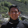 Jhon Jairo Tello, website manager of Terra-i project, he is a System Engineer and graduate of the Universidad Cooperativa de Colombia. Since then, he has been working on the development of the web platform and display data of Terra-i project. He has knowledge of different programming technologies for visualization of geospatial data and information in general as JAVA, Google APIs, CartoDB, MapBox, among others.
Paula Andrea Paz
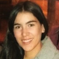 Paula A. Paz is a Topographical Engineer from Universidad del Valle, Colombia, with a comprehensive knowledge and understanding of GIS and remote sensing software tools, with a particular focus on spatial
modeling, land cover change and land-use analyses. Paula is currently working as research assistant, her main tasks include the downloading, processing, calibration and post-processing of data and information for Terra-i to support the monitoring of deforestation in the tropics. Additionally Paula has been involved in projects where analyze (trend and rate analysis, field work) and use the Terra-I data for monitoring and identification of spatial changes in vegetation.
Oscar Bautista
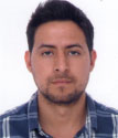 Oscar Bautista is an Agricultural Engineer from Universidad Nacional de Colombia. He has been working since 2012 as a consultant in diverse conservation projects. Moreover, he has been engaged in the identification of ecosystem pressure and threats to assess land-use change and forest loss impact. Currently, he works as a research assistant in DAPA and is part of the team responsible for data generation, download, and processing.
Bernadette Menzinger
 Bernadette Menzinger is a Geografer graduated from Julius-Maximilians-Universitat Wurzburg in Germany in 2014. She specialized as a research assistant supervising land use in West Africa. Currently she is pursuing her masters studies in High Mountain Geography and Climatology at the University of Graz in Austria, and is working as a visiting researcher in Terra-i. She is responsible for updating data, and downloading and processing information.
Thuy Nguyen
 Thuy Nguyen is a GIS and Remote Sensing Specialist based in CIAT Asia Regional Office in Hanoi, Vietnam. She got the Bachelor of Science in Geography from Hanoi University of Science, VNU, and completed her Master degree in Geographic Information Science for Development and Environment (GISDE) at Clark University, MA, USA. Her research interests are the applications of GIS and remote sensing data in various fields such as natural resources and forest monitoring, disaster risk management, mosquito-borne diseases and climate change etc. She is responsible for coordinating the development and expansion of Terra-i in South East Asia countries.
Thi Than Nguyen
 Thi Than Nguyen coordinates CIAT’s work on GIS Research Assistant based in Hanoi, Vietnam. She hold an BSc in Geography from Hanoi University of Science in 2015. She has undertaken remote sensing, spatial analysis, land use mapping, database management and also contributed to develop Terra-i in South- East Asia and crop modelling to assess the impacts of climate change on the suitability of key crops in Vietnam.
Trong Phan Van
 Trong Phan Van is a GIS and Remote Sensing Specialist based in CIAT Asia Regional Office in Hanoi, Vietnam. He got the Bachelor and Master degree in Remote Sensing and GIS from Hanoi University of Science, VNU. He contributes to the development and maintenance of a Terra-i GIS database in South East Asia. His research interests are the applications of GIS and remote sensing data, modeling in land use change under the impacts of Social economic activities and climate change. Furthermore, he used WebGIS integrated technology and satellite image processing multi-resolution, multi-temporal to monitor Forest Fires in Vietnam.
Glenn Hyman
 Dr. Glenn Hyman has over 20 years of experience living and working in the Latin America tropics on issues related to agricultural development and environmental conservation. Glenn has worked on the trade-offs between smallholder farmer livelihoods and environmental concerns related to deforestation and forest degradation, and on land-use change and how it affects greenhouse gas emissions and farmer livelihoods. This work has been in conjunction with economists, ecologists and other professionals to put land-use change in the context of emissions and farmer incomes.
Glenn is currently coordinating CIAT’s participation in the Forests, Trees and Agroforestry Research (FTA) Program of the CGIAR. Glenn’s work within FTA focuses on participatory development of low emissions development strategies (LEDS), on monitoring reporting and verification (MRV) for REDD and ecosystem services programs, on land-use change impacts on multiple environmental services and on the development of the Sentinel Landscapes program.